Sudan
Country statistics
Total area: 1,156,673 sq miles (1,861,484 sq km)
Population (2011 est.; includes the population of South Sudan): 45,047,502 (growth rate: 2.1%); birth rate: 33.2/1000; infant mortality rate: 78.1/1000; life expectancy: 52.5; density per sq miles: 46
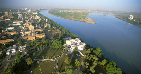
Capital City: Khartoum
Monetary unit: Dinar
Languages: Arabic (official), Nubian, Ta Bedawie, diverse dialects of Nilotic, Nilo-Hamitic, Sudanic languages, English
Ethnicity/race: black 52%, Arab 39%, Beja 6%, foreigners 2%, other 1%
Religions: Islam (Sunni) 70% (in North), indigenous 25%, Christian 5% (mostly in South and Khartoum)
Country introduction
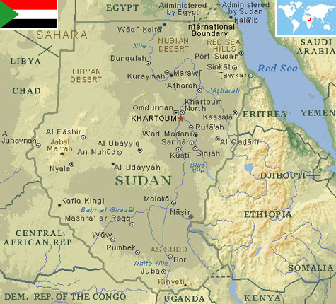
Sudan is located in North-eastern Africa. It is bordered by Egypt to the north, the Red Sea to the north-east, Eritrea and Ethiopia to the east, Uganda, Kenya and Democratic Republic of the Congo to the south, the Central African Republic to the south-west, Chad to the west and Libya to the north-west.
The Nile is the dominant geographic feature of Sudan, flowing 3,000 km (1,864 miles) from Uganda in the south to Egypt in the north. Most of the country lies within its catchment basin. The Blue Nile and the White Nile, originating in the Ethiopian highlands and the Central African lakes, respectively, join at Khartoum to form the Nile River proper that flows to Egypt.
Northern Sudan, lying between the Egyptian border and Khartoum, has two distinct parts, the desert and the Nile Valley. To the east of the Nile lies the Nubian Desert; to the west, the Libyan Desert. They are similar, stony, with sandy dunes drifting over the landscape. There is virtually no rainfall in these deserts, and in the Nubian Desert there are no oases. In the west there are a few small watering holes where the water table reaches the surface to form wells that provide water for nomads and caravans. Flowing through the desert is the Nile Valley, whose alluvial strip of habitable land is no more than 2 km (1.2 miles) wide and whose productivity depends on the annual flood.
Western Sudan is a generic term describing the regions known as Darfur and Kurdufan that comprise 850,000 sq km (528,166 sq miles). Traditionally, this has been regarded as a single regional unit despite the physical differences. The dominant feature throughout this immense area is the absence of perennial streams; thus, people and animals must remain within reach of permanent wells. Consequently, the population is sparse and unevenly distributed. Sudan's third distinct region is the central clay plains that stretch eastward from the Nuba Mountains to the Ethiopian frontier. The central clay plains provide the backbone of Sudan's economy because they are productive where settlements cluster around available water.
The southern clay plains extend all the way from northern Sudan to the mountains on the Sudan-Uganda frontier, and in the west from the borders of Central African Republic eastward to the Ethiopian highlands. This great Nilotic plain is broken by several distinctive features. First, the White Nile bisects the plain and provides large permanent water surfaces such as lakes. Second, the Sudd, the world's largest swamp, provides a formidable expanse of lakes, lagoons, and aquatic plants, whose area in high flood waters exceeds 30,000 sq km (18,641 sq miles). The highest point is Mount Kenyatta, 3,186 m (10,456 ft), located in the Immatong mountains, close to the Ugandan border. Its greatest width measures about 2,253 km (1,400 miles), and its length is 3,218 km (2,000 miles).
The culture

Attractions & landmarks